 Map of the greatest extent of the Mongol Empire (Shaded area that of the Timurid empire) early 14th Century
This is a brief history of the rulers of the region today known as the Republic of Karakalpakstan. Encompassing the lands south of the Aral Sea, the lower delta of the Amu Darya River, the Ursturt Plateau to the west and the Kyzylkum Desert to the east.
The first inhabitants of the region were the cattle-breeding Apasiak marsh dwellers, part of the Saka-Massagetae, which populated the delta and the adjoining desert lands of Aral-Caspian in the early 1st millenium.
Irrigated agriculture started to develop in the lower flow of the Amu-Darya river by sometime in the mid 2nd millenium and by the 10-8th cc. BCE the beginnings of the Chorasmian civilization started to emerge.
During the 7-5th cc. BCE as more advanced irrigated agriculture developed with the construction of the large diversion canals, fortified settlements and multiple villages this becomes more formalised and a specific Khorezm state developed known as CHORASMIA. Some 300 fortresses and temples are still from this epoch are still to be found in Karakalpakstan and adjoining Khorezm.
CHORASMIA which was established perhaps as early as c. 1300 BCE, next to nothing is remembered about it's early history.
Sijav..............................................fl. 1300's BCE ?
Vishtaspa.......................................fl. c. 1000 BCE ? is recorded in Zoroastrian scripture as the first patron of the prophet Zarathustra (Zoroaster).
Aurvat-Aspa....................................... fl. late 600's
Arsames (Arshama)................................early-mid 500's
To
PERSIA..........................................530-350 BCE
Hypastes (Vishtaspa)..................................mid 500's-495 with...
Darius (Darayavahush; Persia 522-486).............530's-522 BCE
To the
PHARASMANID.........................c.330 BCE-300BCE
Chorasmia however maintained its independence from the Hellenistic kings of both Bactria and the Seleucid Empire, and was probably only loosely associated with the Parthian Empire.
Pharasmanes (Pharashmanaya)..................fl. 330's-320's
The silk road trade route starts up in this era. The Pathians and Kushans both derived much of their revenue from the caravans crossing their territory carrying silk, gold, silver, and nickel from China to the Persians.
Vassal of
PARTHIA................................c.200 BCE-27 CE
Chorasmia maintained its independence from the Hellenistic kings of Bactria and the Seleucid Empire, and was only loosely associated with the Parthian Empire.
Vassal to the
KUSHANS...............................27-305 CE
The Kushans replaced the Greeks in Bactria in about 130 BC. They were mainly Yüeh-Chih a Buddhists people probably of Iranian stock with a strong admixture of Hephthalites (white huns), Saka, and Tocharian.
To the
AFRIGID ...............................305-410 CE
In Khoresm in the early part of the 4th Century the Afrigid kings rose to power; their dynastic symbol – a horseman.
Afrig..............................................305-320
Bagra..............................................320-340
Sakhkhasak............................................??
Askadjamuk I ..........................................??
To the
WHITE HUNS .................................. 410-565 CE
In AD 400 a new wave of nomads under the Hephthalites (believed to be eastern Iranian stock) emerged as rulers of much of Central Asia.
Hephthalites.......................................410-415
Askadjavar I.......................................415-445
Sakhr I ............................................... ??
Shaush .................................................??
To
WESTERN TURKIC KHAGANATE, mid 6th- early 8th cent.
In alliance with the Sasanians, the Turks attacked and destroyed the Hephthalite empire (in AD 560), thereby gaining control over an important portion of the Silk Road leading from China to Byzantium and ruled the area right up until the Muslim conquest.
Gök...................................................565-652
Khamgari ..................................................??
Buzgar ....................................................??
Arsamukh...........................................fl. c. 600
Sakhr II ..................................................??
Sabri .....................................................??
Askadjavar II..............................710-712 opposed by...
Hurrazad...........................................fl. 710-712
Askadjamuk II...........................................712- ?
To the
CALIPHATE.......................................c. 710-867
Under Abd al-Malik the Umayyad caliphate (661-750) conquered Khwarezm, Samarkand, Bukara, Fergana, and Tashkent and began an extensive program of Arabisation and conversion of the population to Islam. It was followed by the Abbasid caliphate (750-861) after which it collapsed as anarchy and rebellion shook the empire and local muslim rulers emerged.
To
LOCAL PERSIAN RULERS.................................................867-900
In 875, the Samanid emir, Nasr I, receive a license from the Caliphate to govern all of Transoxania.
To
SAMANIDS ...........................................900-c-1010
An Iranian dynasty who emerged after the Muslim Arab conquest and ruled from Bukhara until overthrown by the Mongol (Khitans).
In 892 Ismail ibn Ahmad ascended the throne and embarked on an ambitious struggle to convert Maverannahr (Transoxania) into a major power in the Muslim world. Under his rule, his state embraced the territory of all of present-day Uzbekistan, the northeast provinces of Iran, part of Afghanistan and South Kazakhstan.
Ismail I.............................................900-907
Ahmed II.............................................907-914
Nasr II..............................................914-943
Nuh I................................................943-954
Abd al-Malik I.......................................954-961
Nasr III...................................for 1 day, in 961
Mansur I...........................................961-976/7
Nuh II.............................................976/7-997
Mansur II............................................997-999
Abd al-Malik II..........................................999
Ismail II............................................999-1005
In 1005 the last Samanid ruler, Abu Ibrahim Ismail the Muntasir (Arabic for "victorious"), was killed and his state was divided between two khanates under the Turkic dynasties of the Karakhanids and Ghaznevids.
To the
GHAZNAVID EMPIRE....................c. 1010-1074
Samanid Turkic rulers who spoke Persian (whose leaders originated from Heart in modern day Afghanistan) and ruled from Samakand.
Mahmud............................................. 998-1030
Mas'ud I ..............................................1031-41
To the
SELJUG EMPIRE..........................1074-1141
Seljug Turkish empire built a vast empire which extended from Byzantium in the west to Tokharistan in the east, led by the ruling military families of the Oguz (Ghuzz) Turkmen tribes who ruled from Merv.
Nasr I Abu'l Hasan Shams al-Mulk..................1068-1080
al-Khidr Abu Shuja................................1080-1081
Ahmad I...........................................1081-1089
Ya'qub............................................1089-1095
Mas'ud I..........................................1095-1097
Sulaiman Qadir Tamghach................................1097
Mahmud I..........................................1097-1099
Harun Tigin.........................................c. 1099
Jibra'il Qadir Khan...............................1099-1102
Muhammad II Arslan Khan...................1102-1130 opposed by...
Nasr II......................................1128-1129 and...
Ahmad II..........................................1128-1130
al-Hasan..........................................1130-1132
Ibrahim II.............................................1132
Mahmud II.................................1132-1141 d. 1163
To the
QARA KHITAL............................1141-1212
In the late 1130s a new formidable power, Qara (Black) Khitai, emerged on the eastern border of the khanate; a nomadic Manchu people originating from the Tarim basin (East Turkistan. In 1141 the Kara-Kitai destroyed the allied armies of the Seljukids and Karakhanids in a battle on the Katvan steppe. They established a ramshackle empire which merged with the Golden Horde in the 13th century. They lent their name to Chitay (Cathay) from which China is named.
Ibrahim III.......................................1141-1156
'Ali II Chaghri Khan..............................1156-1160
Mas'ud II......................................1160-1178 with...
Nasr III........................................1163-1173 and...
Muhammad III.......................................1171-1174
Ibrahim IV.........................................1178-1203
'Uthman Bughra.....................................1203-1212
Briefly to the neighbouring
ANUSHTIGINIDS in Khiva ....................1212-1221
Muhammad Al ad-Din military success led once again to the rise of a powerful state of Khoresm shahs with his capital at Gurganj (Kunya-Urgench) today in northern Turkmenistan. His brief rule however came to an end in 1220/21, when Mongol armies under Genghis Khan swept through the region.
Muhammad Al ad-Din... ............................1200-1221
To the
MONGOLS (GOLDEN & CHATATAI HORDES) ............1227-1395
Central Asia was invaded by the Mongol horde in 1220/21 led by Gengiz Khan. His forces destroyed all of Khorezms cities and towns and absorbed its lands.
Before his death in 1227 he assigned Turkistan to his second son, Chagatai, in the following century the horde gradually Turkified and Islamized especially under their greatest Khan, Öz Beg (1313-40).
Temujin Genghis (Chengiz) Khan.....................................1206-1227
Batu...............................................................1227-1255
Mangu..............................................................1266-1280
Ozbeg..............................................................1313-1340
KIPCHAK KHANATE.....................................1350s-1395
Encompassing most of the western part of the Mongol Empire the Golden Horde flourished from the mid 13th century. The people of the Golden Horde were a mixture of Turks and Mongols, with the latter generally constituting the aristocracy.
Timur's defeat of the Golden Horde in 1395 left a mêlée of different tribes and confederations between the Black Sea and the middle Syr Darya, including the Nogay Horde to the west and the Shaybani (Uzbek) Horde centred in south-western Siberia. Many of the surviving inhabitants of what is now Karakalpakstan being forced to seek refuge in the lower Syr Darya.
TIMURUD EMPIRE.................................1395 to around 1428
Timur Shah (Tamerlane the Great).....................1370-1405
Tamerlane was Emir in Transoxiana for the last Chagatai Khans. Whilst technically he was never the head of state - he was the leader and pursued his own agenda entirely and his putative overlords were purely puppets. On his death his decendents ruled in his name.
Whilst the Mongol invasion was traumatic, it was Timur’s invasion of Khoresm in 1395 that had the most profound effect on the oasis, it not only greatly reduced the population but the invaders totally destroyed (to their foundations) almost all the settlements and demolished the regions ancient irrigation system plunging the northern Amu Darya delta into a 200-year-long ecological crisis.
After Timurs death in 1405 the Timurud empire waned due to family splits and the north western areas of the empire came under the control of the Uzbeks in 1428.
BORJEGIN-Shaybanid ....................................1428 -1468.
During the 15th century many nomads from Siberia began migrating eastwards into the Syr Darya valley. At this time the Karakalpaks fell within the early Shaybanid hegemony under the early Uzbek Khan, Abu'l Khayr.
Abu'l Khayr (at Tyumen).....................1428-1468
Haidar...........................................1468
Devastating attacks by Jungars, Uighur tribes from the east, led to a tribal division along the Syr Darya in the 1460's and the emergence of separate Kazakh and Uzbek confederations. Not long after the breakup the Karakalpaks also started to form a seperate identity.
KARAKALPAK KHANATE ..............................late 1400s to 1759
It is not known exactly when but the Karakalpak Confederation emerged. It seems it started within the eastern part of the Nogay Horde during the 15th century, Karakalpaks moving eastwards in the mid-16th century following the Nogay civil war, first to the Syr Darya and later into the Amu Darya delta. The term Karakalpak it is believed derives from the term Chernye Klobuki (Black Hats) who served as frontier uards under the Kievan Rus.
By the early 17th century the Karakalpaks were stretched across a vast tract ranging from the lower reaches of the river Emba in the northern Caspian, to the Turgai river to the north of the Aral Sea, to the lower and middle Syr Darya in the east and to the Amu Darya delta in the south.
Sirdaq I...............................................fl. c. 1630's
Sirdaq II ...................................................??
Khusrau .....................................................??
Ka'ip Khan I..................................1717-1740
Batir Jani Beg................................1740-1745
Ka'ip Khan II (1745) in Khiva ..................1747-1757
The Amu Darya changed its direction again in the last quarter of the 16th century, flowing northwards back into the Aral Sea and creating an island of virgin marshlands known as Aral. Nomadic Qongrat and Mang'ıt tribes (now considered Aral Uzbeks) entered this empty region in 1620.
The majority of Karakalpaks at that time still remained settled along the upper Jana Darya and the Syr Darya, up until the 1720's when they and their Kazakh neighbours came under further attack from the Jungars. Some Karakalpaks fled east into the Ferghana Valley but the majority moved downstream into the lower Jana Darya.
In 1762 some 20,000 Kazakhs embarked on a massive raid on the remaining northern Karakalpak territories, forcing them even further south into the northern Amu Darya delta, especially along the banks of the Ko'k O'zek.
Here they found natural allies amongst the dissident Uzbeks who, having resisted rule by Khiva, had no desire to see an invasion by Kazakhs. Together the Karakalpaks and these Qongrat and Mang'ıt people were able to repulse further incursions by the Kazakhs and for a time keep Khiva at bay.
Ka'ip Khan I..................................1717-1740
Batir Jani Beg................................1740-1745
Ka'ip Khan II (1745)in Khiva ..................1747-1757
To
KHIVA......................................1759-1873
Despite being nominally part of Khiva from 1759 it was not until 1869 that the Aral peoples were finally subjugated and settled by the ruthless Khan of Khiva, Muhammad Rakhim Khan.
The life of the Karakalpaks during the 19th century was a tough one - living in yurts in the mosquito and disease-ridden lands of the delta; subject to the whims of the Amu Darya; building irrigation ditches by hand to water their crops; unfairly taxed by Khiva; their lives and livestock vulnerable to raids by local Yomud tribesmen during the bitter winters. The majority lived in abject poverty, only their tribal and religious leaders being wealthy enough to maintain a semblance of their traditional culture.
This was a period of much instability and there were continuous rebellions against successor Khiva Khans up until Khiva itself was subjugated by Russia in 1873.
Sayyid Muhammad Rahim II.............................1864-1910
To
RUSSIA..............................................1873- 1919
In the second half of the 19th century, the territory on the right bank of the Amu Darya was annexed from Khiva by Russia forming the Amu Darya Department of the Syr Darya Region of the Turkestan General Governance (1878).
At the conclusion of the Gendiamen’s agreement after which Khiva surrendered to Imperial Russia, the territory of the Karakalpaks, which lay on the right bank of the Amudarya river, was incorporated into Imperial Russia forming part of the Amu Darya section of the Turkistan General- Governorship, whilst that on the left bank it remained part of the protectorate of Khiva.
The plight of the Karakalpaks was not greatly alleviated by the Russian conquest in 1873, although the Russians did improve security and stimulated trade and the growth of agriculture.
Tsar Alexander II...................................1855(1873) - 1881
Tsar Alexander III .................................1881 - 1894
Tsar Nicolas II .......................................1894 - 1917
Part of Karakalpakstan (left bank) was under the
KHIVA (PROTECTORATE)
Sayyid Isfandiyar....................................1910-1918
Sayyid Abd Allah.....................................1918-1920
With the collapse of Imperial Russia at the end of World War 1 real control in Khiva passed briefly to the warlord Djunaid Khan.
Turkistan was occupied by anti-Communist White Forces .....1917-1919
Djunaid Khan.........................................1918-1920
During the civil war most Karakalpaks as with other communities living in Karakalpakstan aligned with the Red Army to rid themselves of feudal Khiva and the murderous White Armies and in 1919 the region became incorporated into the Union of Soviet Socialist Republics.
To the
SOVIET UNION.....................................1919-1991
After the revolution in 1920 the Amu Darya Department was restructured into the Amu Darya Region of the Turkestan Autonomous SSR. The Kara-Kalpak Autonomous oblast was established in 1924 and became part of the Kazakhstan ASSR. In 1930, the Kara-Kalpak Autonomous oblast joined the RSFSR Russian Soviet Federated Socialist Republics. In 1936 the Kara-Kalpak Autonomous oblast was restructured into the Kara-Kalpak Autonomous Republic and was incorporated into the Uzbekistan SSR.
Autonomous Republic within Kazakhstan ASSR...1924-1930
Established as the Kara-Kalpakstan Autonomous oblast within the Kazakh ASSR (Russian SFSR) on the 16th of February 1925.
Autonomous Republic within Russian SSR........1930-1936
Transferred to the Russian SFSR on the 20th of July 1930 and transformed into the Kara-Kalpakian ASSR on the 20th of March 1932 being transferred to the Uzbek SSR on the 5th of December 1936.
The Soviet era saw a radically improvement in the standard of living of the population and the rapid growth of agricultural and industrial production within the republic. The construction of the model city Nukus and universal education and health care. Within a generation the modern Karakalpakstan that is seen today had started to emerge.
Autonomous Republic within Uzbekistan SSR.....1936-
However as a result of this growth, substantial environmental damage emerged during the later part of the Soviet Era.
REPUBLIC OF UZBEKISTAN.............................1991
Since independence (within Uzbekistan) progress towards a modern developed state continues apace. Whilst its agricultural sector is still struggling with water shortages and problems associated with salination & desertification, Karakalpakstan has in the last decade emerged as one of the most important hydrocarbon producing regions in Uzbekistan and has a growing tourism and service sector.
Sources:
Khiva Guidebook 2001 Matyakub Madaminov et al and
http://web.raex.com/~obsidian/centasia.html
 Introduction

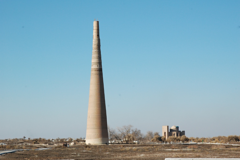
 The city has an astonishing collection of ancient monuments.


 centuries.


